Wondering which kind of waterfront fits you best on Marco Island? With white‑sand beaches, sheltered bays, winding canals, and navigable channels, you have amazing options. The challenge is choosing a shoreline that matches your lifestyle, boating plans, and maintenance comfort. In this guide, you’ll learn how gulf‑front, bayfront, canal, and riverfront homes differ, what permits and design features matter, and how to vet a specific property with confidence. Let’s dive in.
How waterfront types differ on Marco Island
Gulf-front: beach and open Gulf
Gulf‑front homes sit directly on the Gulf of Mexico, often with a sandy beach between the home and open water. You get sweeping horizons, sunsets, and immediate beach access. The tradeoff is higher exposure to waves, wind, and storm surge.
- Pros:
- Private sandy beach experience and daily sunsets.
- Direct access for swimming, shelling, and beach walks.
- The highest “beach lifestyle” premium.
- Cons:
- Greater exposure to surge and waves; stricter elevation and building standards.
- Potential beach erosion and seasonal overwash during storms.
- Typically higher insurance exposure compared with more sheltered locations.
Bayfront: sheltered water views
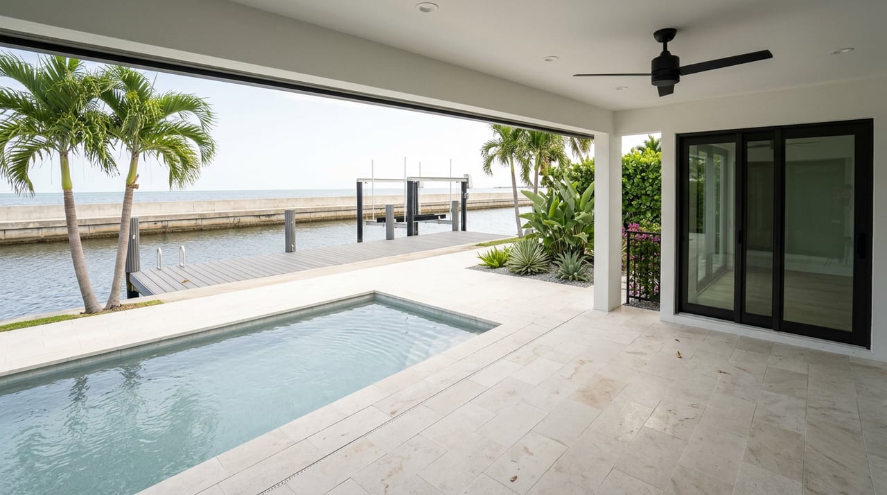
Bayfront homes face protected waters like Marco Bay or Caxambas Bay. Water is calmer than the open Gulf, and views can be serene, with wildlife and mangroves nearby. You may navigate channels or passes to reach the Gulf.
- Pros:
- Calmer water and more sheltered boating.
- Generally lower wave‑driven erosion than gulf‑front.
- Great for paddling, wildlife viewing, and relaxed dock life.
- Cons:
- Shorelines may be mangrove or mudflat rather than sandy beach.
- Water clarity and seagrass beds vary by location.
- Access to the Gulf typically requires channel navigation.
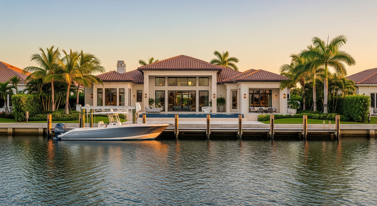
Canal-front: private dock life
Canal‑front homes line a network of dredged or man‑made canals. Lots are often oriented to the channel and include seawalls with private docks or lifts. Water is typically calm for mooring and day‑to‑day boat use.
- Pros:
- Easy private dockage and direct boat access to wider waterways.
- Calmer conditions than open Gulf exposure.
- Popular with owners who prioritize boating convenience.
- Cons:
- Water quality and circulation can vary by canal; occasional stagnation or algae.
- Boat wakes, neighbor traffic, and reliance on seawalls and dredging.
- Possible HOA rules for docks, lifts, or vessel types.
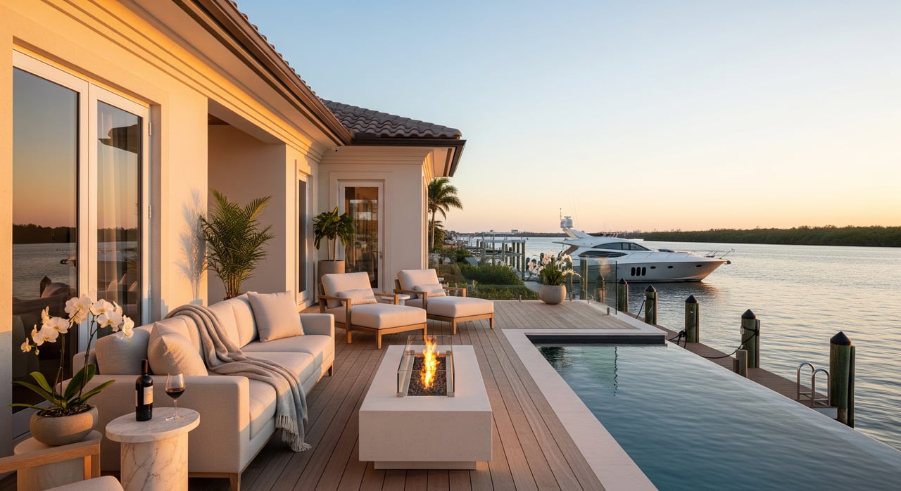
Riverfront: channels and currents
Riverfront properties face tidal rivers or navigable channels that connect the island to larger water bodies and mainland routes. Depths and currents vary, and some routes include bridge clearances.
- Pros:
- Often deeper water and current that reduces stagnation.
- Better suited for larger boats in many segments.
- Scenic waterways and active boating corridors.
- Cons:
- Navigation can be more complex due to tides, currents, and bridges.
- Some reaches may erode faster.
- Noise from passing boats along busy channels.
Design and permitting basics
Elevation, wind, and materials
Waterfront homes on Marco Island must perform in a coastal environment. The Florida Building Code sets high‑velocity wind and flood provisions, and Collier County enforces these standards.
- Expect elevated living areas on many gulf and bay lots to meet required heights. Foundations often use pilings or raised slabs to handle wave action and scour.
- Use corrosion‑resistant and marine‑grade materials for exterior work, fasteners, and decking.
- Impact‑rated windows or shutters and robust roof connections are common for durability and potential insurance credits.
For code references and updates, review the Florida Building Code resources from the Florida Building Commission and local requirements via Collier County Building & Permitting.
Seawalls, docks, and mangroves
Many canal and bayfront homes rely on seawalls or bulkheads. These structures have life cycles and require inspection and periodic repair. Docks and lifts should match your vessel’s size, draft, and lift capacity.
- Shoreline work, including seawalls, docks, dredging, and mangrove trimming, typically requires permits. Confirm with Collier County, the Florida Department of Environmental Protection, and in some cases the U.S. Army Corps of Engineers, Jacksonville District.
- If mangroves are present, understand that they are environmentally regulated. Alterations often require mitigation and careful planning.
- Choose dock types that fit local conditions and your boating habits, and plan for ongoing maintenance.
Flood zones and insurance
Flood maps influence both design elevations and insurance needs. Many waterfront parcels fall within AE or VE zones, which affect required finished‑floor heights and potential premium costs.
- Check your FEMA Flood Insurance Rate Map and Base Flood Elevation through the FEMA Flood Map Service Center.
- Discuss flood and wind policies with local insurance providers to understand how your elevation, structure type, and mitigation features may affect premiums.
Maintenance and long‑term risks
Routine upkeep to plan for
Salt air, sun, and water exposure mean more frequent exterior care. Plan and budget for steady maintenance to protect your investment.
- Seawalls and bulkheads: watch for cracking, tie‑rod stress, and scour. Schedule inspections and repairs.
- Docks and lifts: monitor for corrosion, replace hardware as needed, and maintain pilings or floating components.
- Exterior surfaces: repaint or seal more often, and manage mold and mildew.
- Landscape and shoreline: maintain erosion control, stabilize dunes or mangroves, and clear storm debris.
Storms, erosion, and sea level
Gulf‑front homes face the most wave energy and sand movement. Bayside and canal areas are more sheltered but still experience surge and flooding during strong systems.
- Expect seasonal beach change on open‑Gulf shorelines, with accelerated loss possible during extreme events.
- Rising sea levels can increase tidal flooding frequency and shift marsh or mangrove boundaries over time.
- Review local coastal management updates through Collier County and regional context via NOAA’s coastal resources.
Boating, beaches, and daily life
Access to the Gulf
Your boating access depends on where you live and what you drive on the water. Choose a home that supports your vessel’s draft, beam, and height.
- Gulf‑front offers instant beach access but exposed mooring. Many owners keep boats at protected docks or marinas.
- Canals and rivers provide sheltered dockage but may require navigating channels and passes to reach open water.
- Confirm depths and bridge clearances using NOAA Nautical Charts and local marina guidance. Review rules and safety with the Florida Fish and Wildlife Conservation Commission.
Noise, traffic, and seasons
Canal and riverfront corridors may be more active with boat traffic and wake noise. Gulf‑front areas can feel quieter but see more beach activity, depending on nearby public access.
- Marco Island has a strong seasonal market. Expect population, boating, and dining activity to rise during winter months.
- For broader area context and events, explore the Marco Island Chamber of Commerce.
How to evaluate a specific property
Use this quick checklist to protect your due diligence.
- Confirm the exact waterfront type by survey and deed, including shoreline boundaries.
- Pull current FEMA flood zone and BFE data, and request elevation certificates.
- Verify finished‑floor heights and structural details against code requirements.
- Review permits for the seawall, dock, dredging, and any mangrove work, and check for open violations with Collier County and the Florida DEP.
- Hire a marine contractor to assess seawall, tie‑backs, dock pilings, lifts, and any signs of scour or subsidence.
- Confirm navigation routes, channel depth, and bridge clearances with NOAA Nautical Charts. Ask about dredging schedules or owner‑maintained canals.
- Discuss flood and wind insurance options early, since coverage terms and deductibles can shape your total cost of ownership.
Which waterfront fits your lifestyle?
Match your priorities to the shoreline to narrow your search quickly.
- Choose gulf‑front if your top priority is a private sandy beach and open‑water sunsets, and you accept higher exposure and stricter building standards.
- Choose bayfront if you want calm water views, easy paddling, and sheltered boating with fewer wave‑driven erosion issues.
- Choose canal‑front if you want everyday convenience for your boat, quick dock‑to‑water routines, and generally calmer conditions.
- Choose riverfront if you run a larger or deeper‑draft vessel and value deeper channels and direct routes, and you are comfortable with tides and bridge planning.
Ready to explore Marco Island waterfront?
If you want a home that fits your boat, your beach time, and your maintenance comfort, you deserve a tailored plan. I pair local knowledge with a design‑minded, concierge approach so you can compare options clearly and buy with confidence. For a curated shortlist and expert guidance, connect with Marius Stoia. Request a free consultation & home valuation.
FAQs
What is the main difference between gulf-front and bayfront homes on Marco Island?
- Gulf‑front offers sandy beach and open‑water exposure, while bayfront provides calmer, more sheltered waters with easier boating in protected areas.
How do flood zones (AE vs VE) affect a waterfront purchase?
- VE zones indicate wave action and often require higher elevation and stronger structural design; AE zones are floodplain without wave impact but still require compliance and may affect insurance.
Do I need permits for a new dock or seawall repair on Marco Island?
- Yes. Shoreline work typically needs approval from Collier County, the Florida DEP, and sometimes the U.S. Army Corps of Engineers.
Which waterfront type is best for larger boats?
- Riverfront and some canal segments often provide deeper water and better clearance; always verify depths and bridges using NOAA Nautical Charts.
What maintenance should I budget for with a canal or bayfront home?
- Plan for periodic seawall inspections and repairs, dock and lift upkeep, exterior repainting or sealing, and shoreline stabilization as needed.
How can I check if a property is in a flood zone and its elevation?
- Review FIRMs at the FEMA Flood Map Service Center and request the property’s elevation certificate to confirm finished‑floor heights.